Stalking the Elusive Carolina Petroglyph
I’m driving north. U.S. 301. I pass through Enfield and head toward Halifax. I’m looking for the bridge over Fishing Creek.
I’m hunting—hunting something that might be found lounging on the banks of the creek—or maybe it’s long gone. That’s why it’s a hunt. What I’m tracking down is something not mentioned in recent books on tourist attractions in North Carolina, or North Carolina historic sites. There won’t be any visitor center or historical marker to aid my search.
But if it is there, I should find it. I’m hunting a petroglyph— or at least what I think must be a petroglyph. I’m guided entirely by a single entry in the WPA Guide to the Old North State published in 1939. I’ve seen no other reference to this petroglyph in the literature.
But the WPA Guide states: “U.S. 301 crosses Fishing Creek near which bones of an ichthyosaurus were excavated some years ago. On the creek bank is a large flat stone impressed with human and animal footprints and intricate designs.” I’m hoping to park next to the bridge, walk down to the creek, where I’ll spot that flat stone. And then I’ll marvel over the ancient carved footprints and intricate designs. Petroglyphs are inscriptions or carvings on naturally occurring rock faces.
Native Americans have left thousands of these carvings across the United States. Petroglyphs sometimes clearly portray animals or hunting scenes, but many carvings are of hand prints, foot prints, and bizarre human like figures that are not easily interpreted. Pictographs are paintings on naturally occurring rock faces. Many petroglyphs and pictographs are of a great variety of geometric symbols or figures.
Some petroglyphs were made by those of European heritage in more recent times. But regardless of their origin, it is true that these rock carvings and paintings are not fast moving. You’d think the petroglyph hunter would have the advantage. But you might be wrong.
The existence and location of petroglyphs and pictographs are often well protected secrets by those who know of them. That’s why directions to the rock art sites, or even mention of their very existence, sometimes disappear from the literature. Unfortunately suppression of this information has some justification. Vandalism of well known petroglyph/pictograph sites seems to be as common as it is inexplicable.
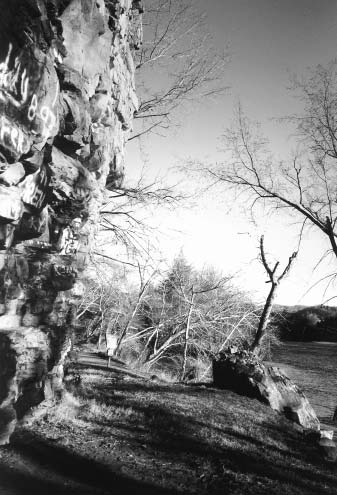
There is a lovely, unmarked pictograph site I visited in southern California (with an actual shaman’s cave) where every rock face is covered with spray painted graffiti. And then there is Paint Rock—a sheer 100 foot cliff overlooking the French Broad River near Hot Springs, North Carolina. According to the WPA Guide: “The 1799 boundary commission, surveying the boundary line (NC and Tennessee) reported that the red stains’ on the rock resembled the figures of some humans, wild beasts, etc.’” Though the WPA Guide suggests these figures are just oxidation of iron in the rock, it seems fairly clear that these were Native American pictographs.
I couldn’t find them anymore when I visited Paint Rock. But I did find a sheer rock cliff completely defaced with spray paint. On a recent visit to Wyoming, my sons and I stopped by Register Cliff—another sheer rock face that rises in a pretty valley next to the famed Oregon Trail near the town of Guernsey. Register Cliff is covered with carved names and dates, ranging from those who traveled the Oregon Trail in covered wagons in the mid-1800s to teen-age tourists to the rock who had too much time on their hands in the 1980s and 1990s.
Carvings from the 1880s overlay carvings from the 1840s and 1850s. And 1940s and 1950s inscriptions are scratched in between—with more recent spray painted versions over all. I guess it is all graffiti, whether 150 years or 15 years old. In time maybe even the 1960s or 1970s graffiti may become more interesting.
But now it’s just sad and annoying. Okay, I see the bridge up ahead and the sign says “Fishing Creek.” Here we go. I pull over, park and hike to the river. The water is high.
I scan both banks. I walk to the downriver side of the bridge and again scan both banks. I walk a short ways along both banks of Fishing Creek. If there is a large flat stone near the U.S. 301 bridge over Fishing Creek, I don’t see it.
Maybe the rock is in the river covered up by the high water. Maybe it is actually a half mile or so from the bridge. Maybe the rock has been moved or destroyed in rebuilding the bridge. Whatever.
Mark it down as just another petroglyph that got away. Another of many that have eluded this petroglyph hunter. So now I’m walking along the bike path that parallels Western Boulevard near Pullen Park in Raleigh. Up ahead, across the road, I
see the walls of Central Prison. But I keep looking over to my right— I’m looking for any well-trodden or faint path that will lead down to Rocky Branch—the little stream that runs parallel to the bike path on its south side. I’ve found another petroglyph reference to hunt down. This one is supposed to be on a large stone between Dorothea Dix Hospital and Central Prison on Rocky Branch, and the inscription is supposed to be: “1865 Wilson Dixson Co.
C 1st no. Eng.” It would have been carved by soldiers in General Sherman’s army in the spring of 1865 during the several days the army was camped in and around the hills near where the Farmer’s Market is found at present—on Centennial Drive just south of downtown. Union soldiers must have wandered down to Rocky Branch from their campsite for a cool drink and idled by the rocky banks. It was after the Battle of Bentonville and before the final surrender at Bennett Place, that the Union’s 14th Corps, seventeen thousand men strong, were in this camp.
They were there on April 17, 1865, when Sherman informed them that Lincoln had been assassinated. Raleigh residents feared they would suffer the destruction that Sherman’s army had inflicted on Atlanta and Columbia but somehow Sherman and his officers restrained the men and Raleigh was spared. It is often the case that unmarked points of interest—like Civil War petroglyphs—have well-worn dirt paths that lead off the main trail or road to the site. So at every place where I think I can discern a definite or faint footpath going down to the stream, I follow it.
It’s never more than a few yards. And I scan all the rock faces and look for more paths. But I see nothing even though I check all the likely suspects until I have passed the last razor wire of Central Prison. There has been extensive roadwork on Western Boulevard.
And many of the high banks of Rocky Branch have collapsed into the creek. Maybe the carving has been removed or destroyed by natural processes or the DOT. Or maybe the petro is just wary and solitary. And wily.
Disguises itself as a natural rock, maybe. I guess. Or hides behind lichens. Another empty handed sortie for the petrohunter.
If you drive U.S. 64 between Highlands and Cashiers and turn south on Whiteside Mountain Road (turn where you see the sign to Wildcat Cliffs Country Club) and proceed one mile to the parking area, you can hike the two mile loop trail that goes to the top and along the ridge of Whiteside Mountain. I’m there now. The summit is 4,930 feet and its great cliffs of exposed rock rise about 2,000 feet above the valley floor. A spur off the main ridge is known as the Devil’s Courthouse.
It is said that in the 1950s would-be developers of this area discovered a Spanish inscription at the Devil’s Courthouse. The letters in the inscription, said to be two inches high and a quarter-inch deep, read: “T.T. Un Luego Santa Ala Memoria.” Some have suggested that the carving was made by one of Hernando de Soto’s men in 1540, as they trekked north from Florida and then west toward Tennessee. De Soto’s expedition may have followed the old Indian path that ascended Whiteside Mountain from Whiteside Cove on its way westward.
Hard to say what the inscription might have meant— if it is there, because, as you must know by now, I never found it. I walked the Whiteside Mountain loop, was mesmerized by the views, followed all the side trails and wandered over several exposed rock faces but never found a hint of an inscription. Interestingly, the 1939 WPA Guide, although it discusses Whiteside Mountain, never mentions any such Spanish inscription on the Devil’s Courthouse— which it describes as “a jutting formation on the east side of Whiteside.” Other more recent descriptions of Whiteside also fail to point out any 450 year old Spanish petroglyph worth visiting while hiking the summit.
Hmmmm. Another one of those elusive petroglyphs. The last petro hunt I’ll tell you about was also the one I felt most confident about. For this one I had the word of a friend that these petroglyphs existed and that he had seen them back in the 1980s.
I went looking for them but found nothing. I left several petulant and increasingly surly messages for my friend and a few months later he e-mailed me that he had gone out himself and located the glyphs. They were still there, he said. His directions weren’t that specific but the area to search just wasn’t that big.
If they were there I knew I could find them—so I enlisted the help of the petrohunter’s two offspring with the promise that we would find the carvings. The three of us would stalk, discover and flush the shy petros. And a dollar to the first one to sight the prey. These petros were likely carved by the young son or sons of the family who ran the mill at Few’s Ford in Durham County in the mid-1800s.
William Few bought land on the Eno River in Durham
County in 1758. Where Few’s Falls tumbles over a rocky ridge in the river, Few built a mill. Below the falls was the still shallow water of Few’s Ford. William Piper took over and ran the mill in 1831 and Alexander Dickson took his turn with the mill in the 1850s and sold the land in 1863.
The Piper-Dickson House now stands at Few’s Ford in the Eno River State Park—at the end of Cole Mill Road, northwest of the city of Durham. On the side of the Eno River opposite the Piper-Dickson House was where the carvings are said to lie. I know the area well. We walked down past the Piper-Dickson House, forded the Eno and set to examining all the flat rock faces on the banks and in the river.
We went upriver past the falls. We went downriver past the ford. We went inland looking for exposed rock faces—anywhere a kid might decide to devote some significant time to scraping his initials and the date into the living rock. And we found no such letters or numbers.
Nada. We didn’t even scare up a crayfish under the Eno River rocks. And I’m wondering about my good, knowledgeable, petroglyph-loving friend. He says he’ll have to show me himself one of these days.
But if truth be told, this unsuccessful petroglyph hunter is not really so disappointed at all these failed hunts. Simply reading or hearing that these rock carvings may exist, that they may be out there enduring the elements and the years, brings a smile to my face. And wandering up mountains, down streams and through the woods, looking for a likely place that someone might choose to sit a spell and laboriously carve out a message for the ages, is wonderful fun. Maybe not everybody’s idea of fun, but it is for me.
And I’m also conflicted. I’m not sure I want there to be well-trodden paths that mark the way to these rock carvings. The spray paint and other vandalism might not be far behind. Maybe these petroglyphs should remain unpublicized, rarely seen and elusive.
As a matter of fact, maybe I actually did successfully stalk and stumble upon each—or some—of these petros. Maybe I’ve got the photographs to prove it. And maybe not telling you, and leaving you guessing whether they are there or not, and if so, where, is what’s best for both the petros and my fellow petrohunters. Maybe so.
But if you take up the hunt and discover one of these petroglyphs, why don’t you send me an e-mail and let me know. Some general directions would be nice.